The Rambling Diaries: the walks as experienced by the walkers
-
Recent reports and pictures from our walks:
- Photos and commentary from the Creeton Walk, 27 October 2022
- Report and pictures from The Barnack and Southorpe walk: 13th October 2022
- A history of Peterborough Ramblers in cakes!
- The first ever Paxton Walk: 30 September 2022
- The Bourne Forest Walk: an eccentric interpretation with pictures (23 Sept)
- The Helpston Walk and thoughts of John Clare
- From Folksworth to Folksworth: the 8 September Walk
- The Barnwell Walk: August 2022
- The Upwood Walk in pictures with occasional words
- The Ashley Walk in pictures and signposts
- Pictures from the Little Gidding walk
- The Helpston Walk in words and pictures
- The Wansford Walk 30 June (part 4)
- The Wansford Walk 30 June (part 3)
- Pictures from the East Carlton Country Park
- The Wansford Walk 30 June (part 2)
- The Wansford Walk 30 June (part 1)
Past walks and events…
- The walks of 2022 – in words and pictures
- Photos from the 2021 walks in alphabetical order
- The 2021 AGM and Christmas events
- The Christmas Meal 2021
- The second set of Christmas Meal pictures
- Peterborough Ramblers at Play (a joyful moment’s pause during a Thursday walk)
- Sawtry: the great surprises report. A description of some of the more unexpected sites spotted during the 14 April walk.
- The Sawtry walk – 14 April – in pictures and words
- Willowbrook Farm, and a new insight into reality: the 6 April walk
- The amazingly extraordinary Great Easton Walk, including the contribution of a photographer with no idea how a camera works.
- The Torpel Way walk
- Lutton: the additional pictures
- Free Map Familiarisation Course – 5 July 2023
- Milton Ferry Bridge
- Fotheringhay in the mud: the walk report (with pictures)
- The Ryhall Walk Part 2 with added beasts
- The Ryhall Walk January 2023
- Burghley House Part 2: the Lincolnshire nobody knows
- Burghley House Walk (with added fungus) 5 January. Pictures and commentary
- Apethorpe part 3: the conclusion
- The Apethorpe Walk Part 2: 29 December 2022
- The Apethorpe Walk Part 1
- The Nassington Walk, 8 December . The most glorious images.
- The Alwalton Walk 1 December 2022. Pictures and commentary.
- The 2022 AGM: The Pictures and the walk
- The 2022 AGM: The 51st annual general meeting
- The Christmas Meal in Pictures!
-
Recent walks in pictures
- Lutton: the hamlet and the silent world beyond. The February 2023 walk.
- 5 Go Wild in Cambridge: an unofficial event and a thought on the importance of friendship
- Milton Ferry: the pictures. (Please note some questions have been raised as to the veracity of the commentary on this walk).
- The Manton Walk February 2023 in pictures with some dubious words.
- The Stilton Walk in words and pictures (although not in the right order)
Other recent walks
- Stockerston pictures and commentary pictures and commentary (part 1)
- Stockerston Walk in pictures, part 2
- The Stockerston Walk in pictures and commentary part 3
- Kings Cliffe Walk in pictures with rambling notes
Wittering to Thornhaugh Walk 26th August.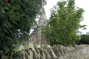 A very well supported walk set out from All Saints Church, Wittering, accompanied by the local vicar.
The original village has been dwarfed by service housing, mostly now privately owned, but built originally for nearby RAF Wittering.
Walk leader Geoff had devised a treasure hunt quiz, with the clues along the route, and a bottle of wine to the most observant.
This meant that the group had regular stops to answer the sometimes fiendishly devised questions. The first stop being next to the sewage works as we left the village !
 Fortunately we were soon into some attractive woodland and undulating fields as we made our way to the village of Thornhaugh and skirted around the well manicured grounds of Thornhaugh Hall Estate. Some remembered the tragic connection of the Hall to the owner, killed nearby in a helicopter crash a few years ago.
With the bottle of wine awarded to the most successful treasure hunter, we returned to Wittering, where some of us adjourned to the local pub for a post walk pint. The pub loos deserve a mention ! Recently refurbished, I have never seen smarter pub toilets! Recommended.
There are more pictures of this walk here.
SAWTRY 15 AUGUST 2021
By Muddy Boots
 This Sunday walk was at last taking place after two cancellations over the past eighteen months. It had been originally planned as 8.5 miles but because of a footpath closure had to be re-jigged to just over 7. Ten of us met on a cool, pleasant morning at the car park in St Judith’s Lane Sawtry with two new members joining us.
The plan was to take a walk that explored the rolling wheat fields of Northwest Cambridgeshire, passing through Little and Steeple Gidding then finishing with a walk through the length of Aversley wood. So that is what we did.
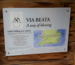
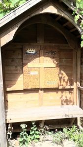 Mid-august is for harvesting and farmers do not take a rest on Sundays at this critical time. Our first encounter with one of their monster machines was in a farmyard, seeing the operator fiddling with the on-board computer before setting out into the fields. We took a short coffee stop in the well-tended garden of the Friends of Little Gidding, existing to maintain the beauty and spirituality of the church and its surroundings. Also celebrated is the connection with the poet TS Eliot, who’s “Little Gidding” was the final part of his Four Quartets. The Via Beata is a long distance footpath between Lowestoft and St David’s in Wales and Little Gidding is one of the way stations on the rout, marked by a hand carved display.
 With fine views out to the West, we soon pass the church of Steeple Gidding with its small handful of dwellings. More monster machines are at work with tractors dashing about to ferry the wheat to the barns. We pass the now closed footpath that we should have taken and divert along the road to our alternative.
More wheat fields but ahead in the distance we can see Aversley wood, it is becoming warmer and the shade will be welcome. It is also our lunch stop.
 The tracks in Aversley wood can be extremely soggy underfoot, even in summer. However, this year the going is much firmer than I remember for a long while.
The Woodland Trust do a good job in looking after the woods and logging work is currently ongoing to maintain the site, including dealing with ash dieback. After exiting the wood, in a short distance we see the roofs of Sawtry ahead. We enter St Judith’s Field, near our walk’s end, where the newly installed skate park is being well used by children of the village.
It was indeed hard to restrain some of our group from rushing forward and pleading with the children to give them a go!
———————-
SPLASH LANE and along the river 5 August 2021
By Dawn Sadler
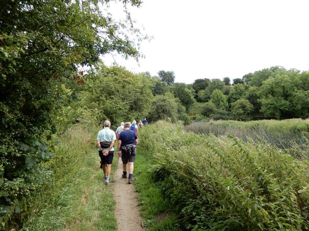
19 Peterborough Group Ramblers met up on Thursday 5th August 2021 to complete the lovely river walk from Splash Lane Castor.
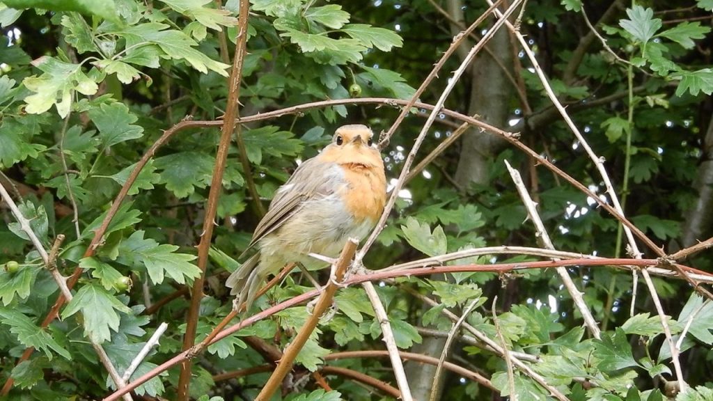
Luckily the rain held off as we all walked across the glorious countryside and never far away from the River Nene on our right. Usually we see lots of boat owners seemingly enjoying their wonderful river wandering lives but today not many were on the water. However a lovely robin blessed the group and even posed for a picture!
Luckily there was hardly any muddy areas on the walk which we were all thankful for. A lovely walk was enjoyed by all with only a few drops of rain at the end.
FOLKSWORTH 22 JULY 2021
By Muddy Boots
It was going to be “scorchio”, as Caroline Aherne would have described Thursday’s weather many years ago on the Fast Show. Several people dropped out because of this and the walk leader decided to cancel. Folksworth is virtually a home fixture for me so I decided to do the walk anyway, being very familiar with the many public footpaths around the village. I posted this on our WhatsApp group, inviting anybody who wanted to join me on what would be a non-Ramblers Association walk and four members of the group opted to brave the weather.
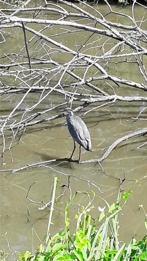
Folksworth village pond, next to where we park, was looking an unpleasant brownish /grey colour. This did not seem to be putting off the water fowl or a number of largish fish swimming just below the surface catching insects. They would have proved far too big for the juvenile heron stood on a large, part submerged branch, its body perfectly still, just its head slowly rotating as it looked for more suitably sized lunch in the murky water. I must have stood for a good twenty minutes, camera poised and wouldn’t you know it, I lowered it for a second and the heron’s head ducked into the water returning with what looked like a good sized goldfish in its beak!
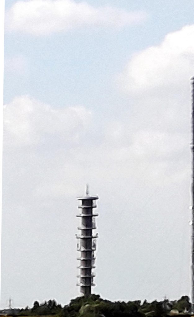
We headed out of the village on a mix of well mown bridle paths, (there is a nearby stable) and overgrown public footpaths. After a short distance we see close ahead of us the mighty 98 metre tall Morborne BT transmitter tower with its adjacent even taller lattice mast, landmarks on many of our walks in the area. The walk is generally unremarkable but we have good views towards Peterborough with the Showground and the huge new distribution centres clearly visible.
Perhaps the most interesting feature of the walk is the site of the medieval village of Washingley that we bypass, recorded in the Domesday Book as having 22 households. A short distance on we pass the site of the small motte and bailey which formed part of the village. Continuing, we enter a small spinney, via a very sturdy stile, onto an overgrown path which contains the site of the village fish ponds and a good sized fishing lake.
We finish our walk, just under 5 miles, back in Folksworth, surprisingly unbowed by the weather, probably helped by the low humidity and a number of water/rest stops.
————-
ASHTON 15 JULY 2021
Muddy Boots
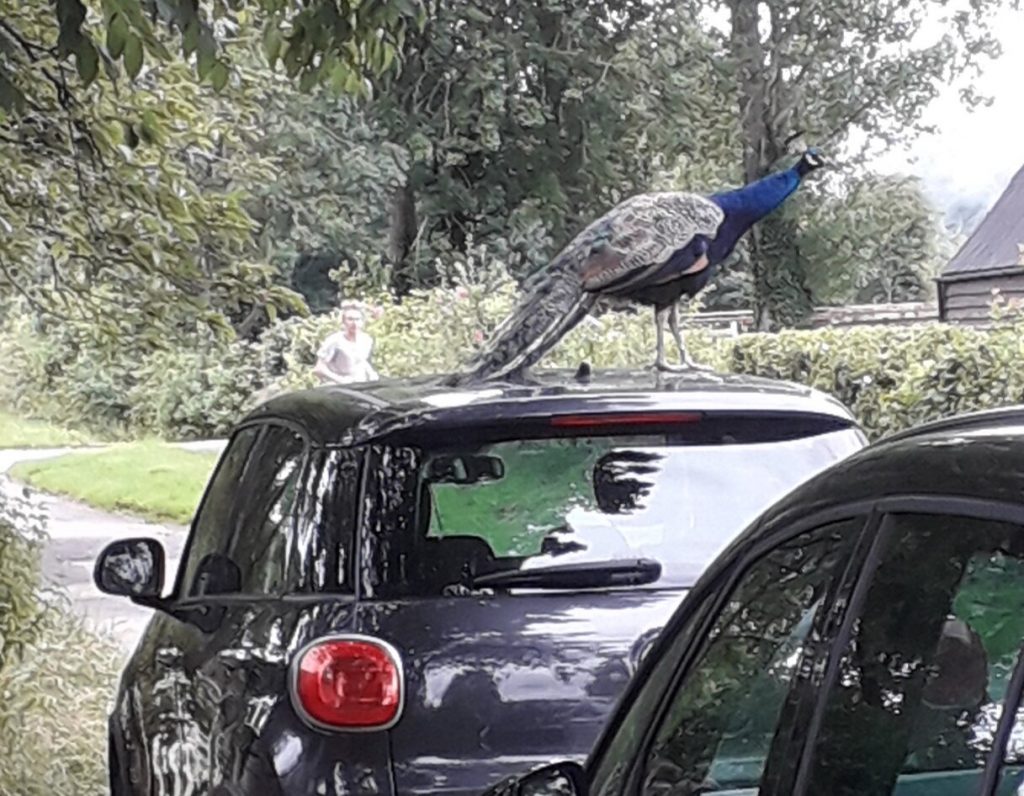
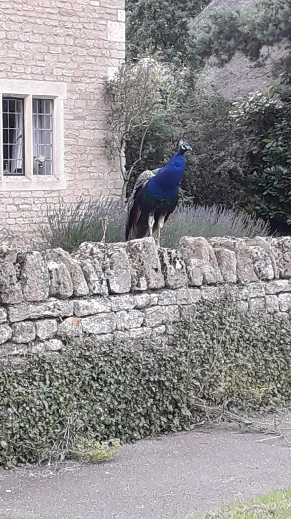
Our walk this week was again led by Stan who last week took us along the banks of the River Great Ouse, this week we are walking out of the small village of Ashton along the River Nene. (Pronounce it as you will). You could easily miss the turning into Ashton, direction to the village being only by a small sign. The village is extremely pleasing to the eye with a muster of peacocks seeming to have free range about the place. Ashton was essentially rebuilt in 1900 by the Rothschild family, mainly Charles, a keen naturalist and conservationist, with water and electricity delivered to the village for the first time from the nearby mill on the Nene.
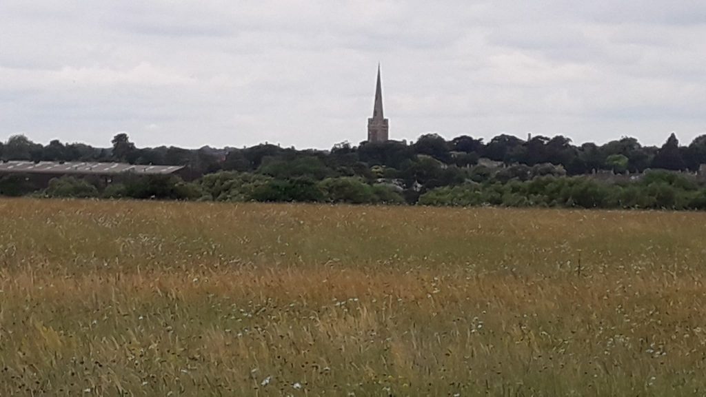
About thirty of us began the walk through the church grounds with the church itself bearing a stone plaque in memory of Charles Rothschild. The public footpath towards Oundle seemed infrequently used, judging by the thick foliage obstructing the path in places, with one or two nettles waiting for the unwary. Oundle church is prominent in the distance to the west, with its extremely distinctive, very tall, narrow spire, a distinctive landmark on many of our walks. We crossed the busy A605 safely, soon joining the footpath along the eastern bank of the Nene, passing through the Oundle School boathouses. The weather was perfect for summer walking, cloudy, not too humid but no chance of rain. We followed the river for about 2km, stopping to watch three river cruisers attempting to negotiate a small lock while at the same time trying to corral their dogs.
After passing a very grand house as we enter Cotterstock village, we go on to pass Cotterstock Hall, almost entirely out of view but apparently an even more splendid building, with the poet John Dryden being a frequent visitor in his day. It was also the location for a 2012 film starring a very famous actor but I leave you to find out who yourselves, answers on a postcard to our webmeister [who incidentally at this moment doesn’t have a clue what the answer is! – Tony]
Leaving the village, now on the west bank of the Nene, we head through pleasant countryside, entering the outskirts of Oundle via extensive sports grounds, more Oundle School property perhaps? Crossing the busy road we turn away from the town, gathering together adjacent to the Tap and Kitchen and Nene Valley Brewery, definitely worth a visit. Dropping down onto the river flood plain we make our way along the bank to the bridge that leads us to the aforementioned mill that provided electricity to the village, regrettably now long closed down.
Our final few hundred metres is along a section of the Nene Way Long Distance Path, bringing us to the end of the walk outside the Chequered Skipper pub, restaurant and wedding venue. The thatched roof pub was apparently gutted by fire in 1996 but has been well restored and a number of us settled down on the green outside for a refreshing drink.
The subject of the world conker championships came up; it took place right where we were sitting from 1965 until 2009. The event, unfortunately for Ashton, then seemed to fall victim of its very popularity as it moved to Southwick a few miles away to enable it to accommodate more players, spectators and stalls.
Next week to Folksworth, regrettably no river but parking near to the village pond if water is your thing.
Stewart Wylie: 8 July 2021: Houghton
A wider selection of photographs from this walk is shown in The walk from Houghton in pictures.
Having moved into the vicinity of Houghton many decades ago, the walk from the village through the Hemingfords and on to St Ives was probably my first exposure to the then Huntingdonshire countryside.
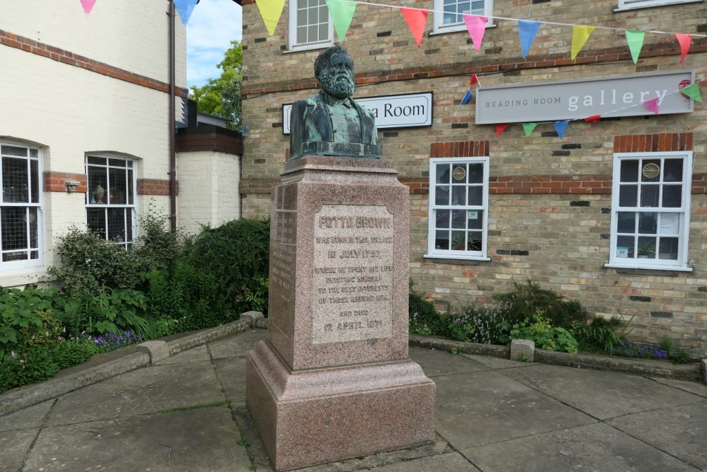
Our walk started in the village centre under the gaze of the well maintained bust of Potto Brown, a local 19th century mill owner and philanthropist. Just 200 metres along Mill Street we see Brown’s imposing Houghton Mill which is reported to have produced flour “on an industrial scale”, perhaps accounting for the still obvious affluence of the local area. After falling into disrepair in the early 20th century, the mill was taken over by the National Trust and was used as a Youth Hostel, which was still its purpose when I first passed by. Today the NT has returned the mill to its original purpose, grinding flour for demonstration purposes, although probably not on an industrial scale!
After passing through the mill and over the River Great Ouse there is a short walk across the large Hemingford Meadow, for a short distance joining the 46 mile Pathfinder Long Distance Walk, linking WW2 Pathfinder Force bases. The very impressive Hemingford Abbots is a grand mix of large, very old and new houses. (A large 6 bedroom thatched property would set you back around £3 million).
The larger village Of Hemingford Gray, sitting on the river is perhaps even more attractive than Abbots, with a fine selection of well painted, timber framed houses. Along the riverside path we passed the rear of “The Manor” which claims to be the oldest continually inhabited house in the UK and open to the public. We crossed, confusingly, another Hemingford Meadow, totally separated from its namesake and in the distance we can see St Ives.
St Ives is my favourite town in the old county of Huntingdonshire. It still has a prosperous appearance, unlike the slightly shabby and run-down look of Huntingdon and St Neots, (just my opinion!). It was in St Ives that my walk, back in the day, would have ended, popping into one of the many fine pubs for a swift half before catching the bus for the short journey home. (The nursery rhyme “As I was going to St Ives” is claimed by the town but it is equally plausible that it refers to the Cornwall location).
We enter the town through the accommodation area of The Dolphin Hotel, with part of its structure raised above ground level to protect against the frequent flooding that covers this part of the town. Crossing the 15th century town bridge, incorporating a chapel, one of only four bridges in England to do so, we enter the busy shopping area, pleasingly still containing an old fashioned hardware shop. Passing along The Waits, I notice a café that I frequented in my youth, still in business, I hope it is still in the same family. We stop outside All Saints parish church where the information board informs us that in 1918 a Royal Flying Corps pilot crashed into the steeple almost destroying it meaning that the steeple had to be restored for the fourth time in its history!
We continue on the last leg, entering St Ives Thicket, now a well shaded asphalt track. The entry into Houghton contains some very large, imposing houses in extensive grounds that can easily rival those in the Hemingfords for their magnificance.
This was a fine 5.5 mile walk in perfect summer conditions, not too hot and the twenty two of us had, I think, a fine afternoon out. Many thanks to our leader Stan and his back marker Marja for a great walk.
Tony Attwood: 1 July 2021
A wider selection of pictures from this walk is shown in The Walk from Helpston in Pictures
Now perhaps I should explain, most of the places we start our rambles from are completely unknown to me. Indeed, even arriving at the right place at the right time and seeing a gaggle of Ramblers awaiting departure is quite an achievement.
(Note: is “gaggle” the correct collective noun for people about to go on a Ramblers walk? I suspect not – I await correction).
We are however always given the postcode and a local reference point. This time it was the The Bluebell pub which was encouraging because a quick glimpse as I drove past at a proper and sedate 25 mph suggested it was open, and thus a restorative drink at the end would be on offer. (Only a few of us indulge – I wouldn’t want you to think this was a drinking club – and several prefer the non-alcoholic; it’s just for a few of us a nice end to the walk).
But because navigation is not my strong point, the sign I am at the right place is a number of cars parked, with people gathering in walking boots. That’s what makes me park up and walk to the gathering (that’s a better word than gaggle, I’ll stick with that of those ready to walk.
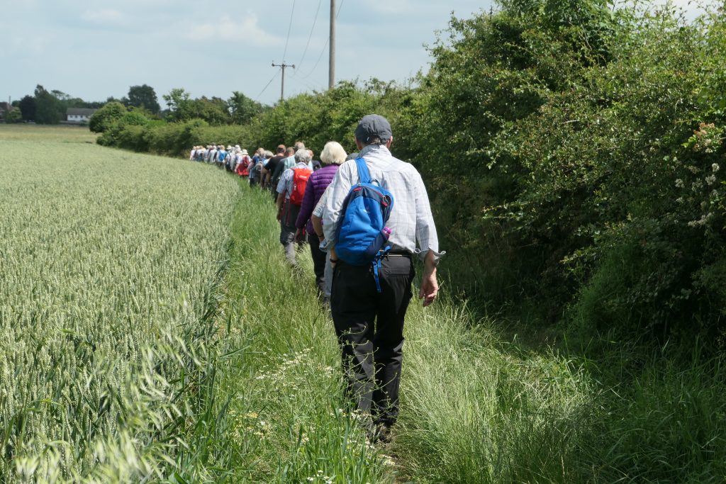
So, there we were. 30 ladies and gents ready for a stroll in the gentle sunshine. Quite a few like me with a light back pack carrying a bottle of water and (in my case) an apple, all a-chatter, (if I may coin the phrase). (Talking is not obligatory on the walk but a fair number of us do it. Some more than others as it turns out.
Of course, if you don’t want to chat, that’s fine, but no matter what your choice, everyone is friendly. Plus once we set off, the scenery is always great, seeing new villages is fun, feeling I am exercising properly is important, but above all (and maybe this is just me) I love the conversations and indeed the growing friendships.
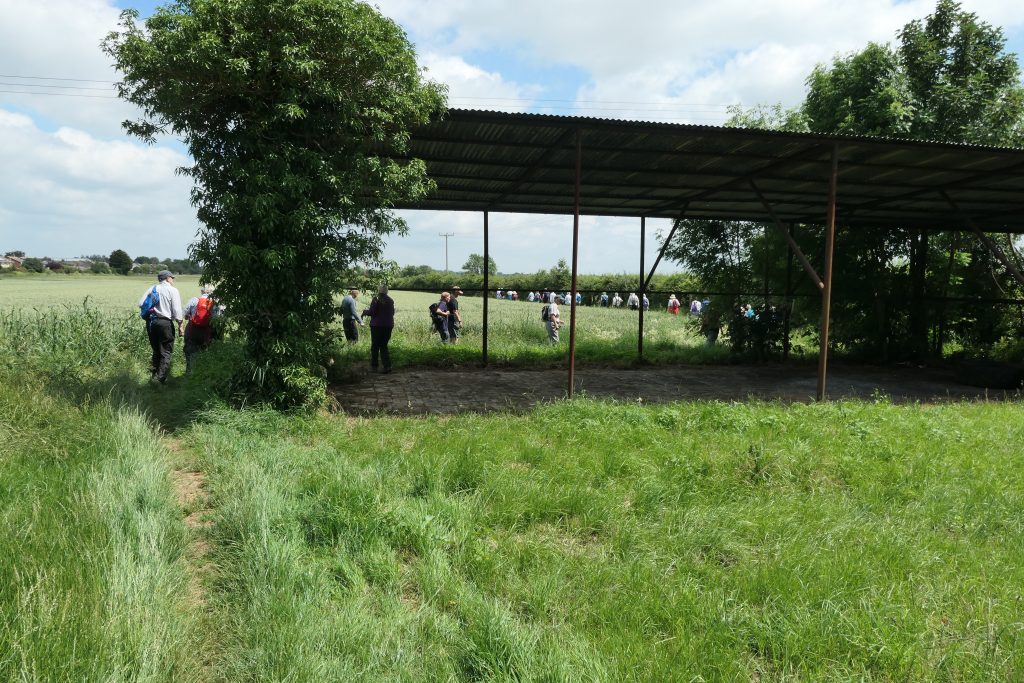
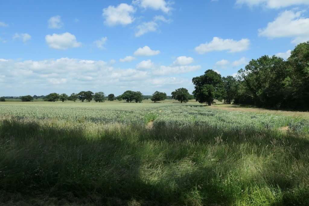
So we walked through fields of crops (I’m actually a Londoner in origin so I can’t tell you what on earth they were, but they were all planted in rows so I suspect they are ultimately edible), and occasionally paused to make sure everyone was still with us. And don’t let the pictures make you think we are always in a straight line. Where the footpath allows walking in suitably distances pairs is permitted!
And for me (and this is a totally personal viewpoint) given that I don’t know my wheat from my origami, it’s the conversations I love. Every walk I fall in with someone I’ve not talked with before and we exchange backgrounds and thoughts on the present day, and it is so remarkably relaxed. I love it.
On this day we (by which I mean about five different groups of two or three I joined at different stages on the walk) talked about the crops in the field, the rock bands we’d seen in our youth, an all-day walking event which apparently was over a 30 mile course (which scared the hell out of me, but I managed to nod as if understanding what would make anyone walk 10 miles let alone 30), and what we are planning for the end of lockdown. Plus other stuff.
And at the end there was something else for me: for although the pub was shut (and I could have done with a restorative half) one of my fellow walkers told me we were at the site of John Clare’s grave.
Now if you don’t know who John Clare was, then you are either a very naughty person or not associated with this part of the world, but I will excuse you and say he was the region’s greatest poet.
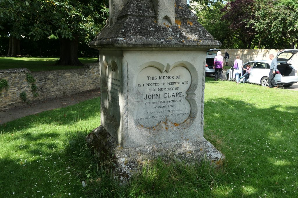
I should add I don’t particularly go around visiting graves of the famous, but it was (for me, and this is of course a personal account) a magical moment to stand in front of John Clare’s grave and pay my respects. A wonderful end to a great two and half hours.
Thank you everyone. I enjoyed every moment.
Tony Attwood
If you would like to join us on a walk, please take a look here