The (diverted) Sawtry walk: pictures from Janet Martyr
Commentary by Tony Attwood
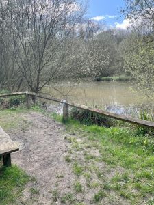
 And may I say immediately that I am absolutely delighted to have a set of pictures from Janet for the second time on a walk. They are a really good set of memories from what was an excellent afternoon out on 13 April 2023.
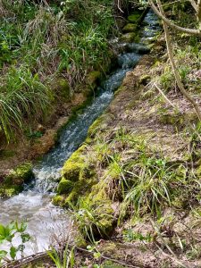
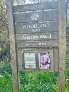
If you were there you might recall that this was a walk that “Muddy Boots” had to re-arranged at the last moment because of the state of the original walk following heavy rain. There were, it seems real dangers of club members vanishing into the gurgling of mud around what is, I think I am right in saying, a Woodland Trust land.
But Stewart, ever mindful of the needs of the more infirm members of the ensemble (such as yours truly) quickly fixed up an alternative but nevertheless equally enjoyable route.
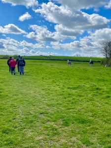
My phone clocked the walk in at just 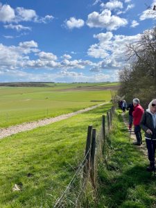 over the five mile mark.
The Woodland Trust website advises us to “Wander among the ash, oak and field maple and you may come across a shy deer or a curious fox.” I am not sure that I saw either, but then I tend to meander around chatting to fellow walkers and looking out for anything that is likely to trip me up and make me look even more foolish than normal.
And yes I guess there was also “plenty of birdlife too” as promised. “Listen for the distinctive drumming of great spotted woodpeckers and watch out for graceful red kites wheeling overhead,” we are told, and quite possibly my fellow walkers took all that in, but again, I’m not too sure I did.
What I really did enjoy seeing however was the remains of the mediaeval ploughing system known I think as “Ridge and furrow”.
It is amazing (to me at least) that these patterns of agricultural use of the land, which must have been created no later than the 1600s are still there and can still be seen, not just on this walk but in various parts of the UK and in Europe.
The ridges can be up to a couple of feet tall now – although they were much taller when created through season after season of ploughing over the centuries.
They came about by ploughing the same strips of land year after year – and when Stewart and I discussed them while taking a modicum of refreshment after the walk in a conveniently positioned tavern, both of us admitted to being completely unclear on how they have survived.
Do such fields have preservation orders on them, or are they simply considered too much like hard work for developers to flatten out?
What I have found out is that all the ploughs of the medieval era turned the soil over to the right, so rather than go up and down the same lane (which would have resulted in no progress at all) the plough moved from one lane onto the next, thus developing the pattern we find in such fields.
Apparently, in mediaeval times the large fields were owned by the villagers in common and each family had its own strips of land to plough.
The raised ridge then drained down into the ploughed lanes (the furrows) and thus ensured that the crops got the moisture they needed even in dry times.
Where fields were left flat it was generally because the soil was always damp either because of the climate, or the nature of the soil.
 Thus given this approach it explains why in the Middle Ages each strip was ploughed in the same way year after year, providing the crops for each individual family.
In this way the movement of soil over time gradually built the centre of each strip up into a ridge – and hence the ridges were formed.
I did in fact learn some of this during my secondary school days in Dorset, and I am most grateful to Stewart for taking the time to remind me of learning lost since lost – and indeed for this walk allowing me to see ridge and furrow agriculture up close.
So a jolly good walk, a spot of education, and a pint at the end. What else is needed?
About The Author
Tony Attwood
This website mostly controls our press officer, but occasionally he manages to wrestle back a modicum of oversight. You can reach him via tony@schools.co.uk