The Stockerston Walk: 3 November 2022
Pictures by Mandy Ellwood, Rambling notes by Tony Attwood
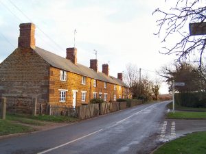
Stockerston is a village in Leicestershire, located on the border with Rutland, by the Eye Brook which is a tributary of the River Welland.
According to the 2001 census the parish had a population of 35. So a little bit smaller than Peterborough.
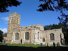
But it does have a church and this fine picture of the Church of St Peter shown below was taken by Tim Heaton.
The Parish contains various woods including the large Bolt Wood, and it is suggested by those who study such things that the woodland is part of that mentioned in the Domesday Book.
Certainly Bolt Wood was around by the medieval era as part of the royal Leighfield Forest known around the reign of Henry VI as Leighfield Forest.
Also nearby is the wonderfully named Little Merrible Wood.
The church as you can imagine is a Grade I listed building, meaning that extensions for the purpose of parties, discotheques and associated 21st century paraphernalia are not allowed without the personal permission of the King.
 The church as it is seen today was built between the 13th and 15th century and there is a memorial inside to John Boyville, largely built in the 13th to 15th centuries. The windows contain some medieval stained glass and the memorials inside the church include a brass that commemorates John Boyville (born 1391 and died around 1467 – meaning he was one of the very few people of the era who managed to see in his 75th birthday, and then some).
He was a major landowner who served as a Member of Parliament for Leicestershire and for Rutland. The inscription on his memorial is of course in Latin, but roughly translated reads, “pray for the souls of John Boivile, a bearer of arms, and Elizabeth his wife who had this bell tower and bells made”.
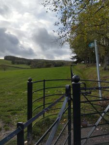
But of course, for the Ramblers the interest is in the countryside although dark and looming clouds reigned over the land intially on the day of the walk.
Scatterings of Roman and Anglo-Saxon pottery have been discovered at Stockerston, as befits a village mentioned in the Domesday Book. In later times it is recorded that two medieval hospitals existed in the village although the notion that either was there to look after pedestrians (or Ramblers as we would know them today) after a quick trip around the locality, has not been confirmed.
Stockerston is recorded as having two medieval hospitals, the first being established in 1307. I would imagine leeches would have been high on the agenda.
The most famous resident, as far as I know, was Anthony Tuckney (I am not sure if his mates called him Tony but it would be nice to think that they did). In 1666 he moved out of London (which if you know your history you will recall was quite warm at the time) and moved to the village in order to avoid being fried.
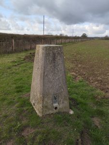
The structure above right is a triangulation point, used in surveying. I am told (unreliably as always) that these points are used to study geodynamical phenomena, including crustal motion, tides and polar motion. I am sure this was discussed in depth on the walk and I am most sorry that I missed the debate.
The village, being as ancient as it is, has no less than ten listed buildings within it – which makes me wonder what the maximum density of listed buildings is, and where that is to be found in rural England. If you know, please do tell.
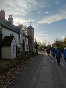
Thus here the group is walking out of the village (although to be fair in a village this small wherever one is walking, one is actually walking out of the village. That’s how it goes).
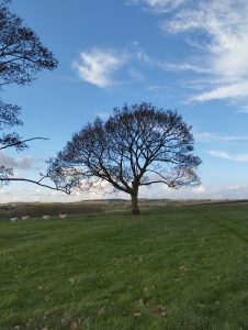
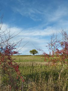
And thus we approach the glorious countryside with much-improved lighting and twirly clouds floating above.
Therefore I leave you for today with the pictures from the walk beyond. If you have more knowledge about the walk, or indeed more pictures, please do send them by email to Tony@schools.co.uk. I shall then update this page.
About The Author
Tony Attwood
This website mostly controls our press officer, but occasionally he manages to wrestle back a modicum of oversight. You can reach him via tony@schools.co.uk